The Golden Pacific Powerlink would put 140 miles of 500-kilovolt transmission line and tower structures through Temecula, along SR 79, Temecula Parkway, Temecula Creek, and the Santa Margarita River. SDG&E's stakeholder feedback window closes in early November, and the utility expects to file its formal CPUC application before the end of the year. That makes this the on-the-record phase, and this valley has a documented history of winning exactly this kind of fight.
The Golden Pacific Powerlink Route Through Temecula, and the Dates That Matter
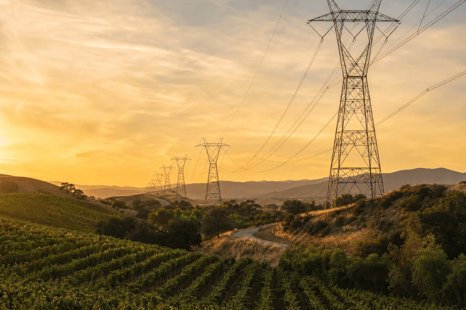
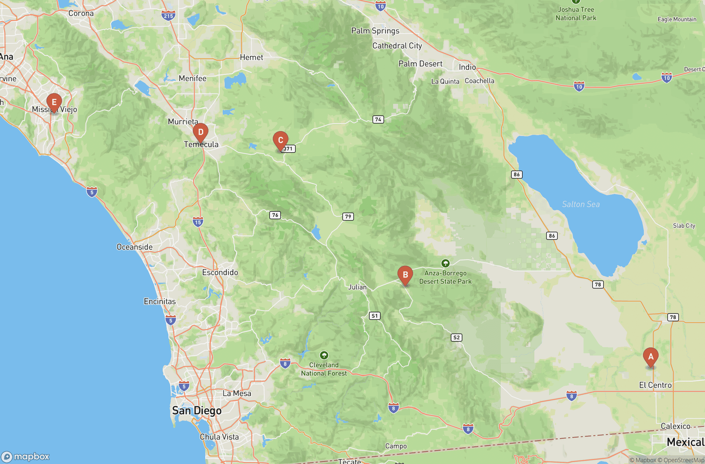
Start with what the project actually is, because the politics only make sense once the corridor is on the table. The City of Temecula's official announcement describes the Golden Pacific Powerlink as 140 miles of 500-kV high-voltage transmission lines and tower structures running through the city, specifically SR 79, Temecula Parkway, Temecula Creek, and the Santa Margarita River. SDG&E spokesperson Alex Welling has described the line as running on towers 120 to 190 feet tall from the Imperial Valley Substation through Anza-Borrego Desert State Park, and stressed that the project remains in early planning subject to CPUC review and approval.
SDG&E's own project website confirms the need for the line was identified by the California Independent System Operator (CAISO), and displays the preliminary proposed corridor running from the Imperial Valley Substation to a new substation to be built in southern Orange County, with the exact route subject to change through environmental review and permitting. "Subject to change" is doing real work in that sentence, and it is exactly the phrase residents should hold onto. Routes change when the record forces them to.
Now the calendar. According to the Anza-Borrego Foundation, which is tracking the project, SDG&E released its proposed route corridor map on April 13, two months ago, and is accepting stakeholder feedback through early November 2026. The formal CPUC application is expected in fall or winter 2026, and the state and federal environmental review is projected to run from fall 2026 to fall 2029.
On the ground, this is already more than lines on a Golden Pacific Powerlink map. SDG&E has not yet submitted permits but plans to at the end of 2026, and biological and archaeological surveys are already taking place, with Morgan Hill residents receiving letters that their properties would be surveyed. If a survey letter has landed in your mailbox, the planning phase has landed in your yard.
Who's Already on Record Against the SDG&E Route
The opposition here is not a vague grumble on a neighborhood app. It is named people with formal positions, and the council chambers have already seen it in person. At the late-May council meeting, hundreds gathered and more than 100 residents directed comments over almost five hours to SDG&E and CAISO representatives. Council Member James "Stew" Stewart put it plainly: "Every seat was taken in the city council chambers and the overflow area in the conference center." Mayor Pro Tem Matt Rahn was sharper, telling SDG&E representatives: "Your map looks like a treasure map on the back of a restaurant placemat. There is only one place you could put this line and that is through Temecula Creek."
Councilmember Brenden Kalfus, a firefighter turned councilmember, was the first on council to release a statement opposing the project: "I do not support their plan to bring the Golden Pacific Powerlink project through the Temecula Valley." His statement flagged that the proposed corridor sits in a high-severity wildfire zone, and coming from someone whose day job involves fire, that carries weight the usual political statement does not.
Residents moved just as fast. A petition launched by Temecula resident Cristina Bracamonte gathered over 1,200 signatures within days, citing wildfire dangers and lowered property values. Pechanga Tribal Chairman Mark Macarro has stated: "The Tribe has serious concerns about the proposed route's potential impacts to Pechanga's ancestral cultural resources and the overall community. We are closely monitoring the proposal and expect our tribal government to be meaningfully consulted."
And Councilmember Zak Schwank gave residents the visual the corridor map doesn't. He walked an existing 500-kV corridor near Perris, along the 215 at Case Road, in a social media video, saying: "If you live along Temecula Creek, this might be in your backyard."
Temecula Has Killed an SDG&E Powerlink Before
Here is the part of this story that should reframe how residents think about their odds. Temecula previously joined forces with the Pechanga Band of Indians to shut down the Sunrise Powerlink through the area, as well as the Granite Quarry, and both came up repeatedly at the May council meeting. The people in those chamber seats were not improvising. They were running a play this valley has run before.
The Sunrise Powerlink was a 117-mile, 230/500-kV SDG&E transmission line from Imperial Valley to San Diego County, estimated at $1.9 billion. The CPUC approved it in December 2008, but only after SDG&E's original proposal to route it through Anza-Borrego Desert State Park was rejected in favor of a route avoiding the park. In Decision D.08-12-058, the CPUC found all routes traversing Anza-Borrego to be "environmentally unacceptable and infeasible," citing the Final EIR/EIS finding of 52 significant, unmitigable environmental impacts, the need to de-designate approximately 50 acres of state wilderness, and heavily contested right-of-way status within the proposed 100-foot corridor.
The CPUC's proceeding materials describe the approved southern route as one that "avoids Anza-Borrego Desert State Park and all tribal lands." Read that twice: avoidance of tribal lands was an explicit criterion in the 2008 rerouting outcome. Tribal opposition did not just get a hearing. It translated directly into route exclusion, which is why Macarro's stated expectation of meaningful consultation is the most consequential sentence any local figure has put on the record so far.
The wilderness barrier is statutory, not merely political. Under the California Wilderness Act, state wilderness within Anza-Borrego, including the Santa Rosa Mountains State Wilderness, is designated by the Legislature, meaning development incompatible with wilderness status cannot proceed without legislative-level boundary action. SDG&E is proposing a corridor through the same park that triggered all of this eighteen years ago, and the same structural obstacles sit in its path.
Wine Country's Joint Opposition and the $1.137 Billion Tourism Economy
The economic case against the route is not a blog argument. It is the industry's own formal position. Visit Temecula Valley and the Temecula Valley Winegrowers Association issued a joint position opposing the proposed route of what the statement describes as SDG&E's 145-mile Golden Pacific Powerlink, citing irreversible damage to regional tourism, agricultural preservation, and public safety. Per the joint position, the line is slated to pass near State Route 79 South, Vail Lake, Galway Downs, and Temecula Parkway via Temecula Creek.
When the tourism bureau and the winegrowers sign the same letter, that is the local economy speaking with one voice, and the numbers behind that voice are not small. According to a Visit Temecula Valley report delivered to the city council in November, tourism in the region generated $1.137 billion in spending in 2024, supports about 9,570 jobs, and produced roughly $52.3 million in tax revenue for the area. The wine country those visitors come for spans 33,000 acres and 47 wineries, per the Winegrowers Association. Anyone who has spent a Saturday on the routes covered in our Temecula Wine Country guide understands what the industry is protecting: the product here is the landscape itself, and the joint position treats the proposed corridor as a direct threat to it.
The Corridor Runs Through Mapped Fire Hazard Zones
For homeowners, the sharpest fact in this fight is already published by the city. Following CAL FIRE's March 24, 2025 statewide Fire Hazard Severity Zone update, the City of Temecula released the official FHSZ maps for its Local Responsibility Area, showing Very High, High, and Moderate fire hazard zones within the city. Local governments were required to adopt the maps within 120 days, which makes this the official designation document for fire-hazard claims along the Temecula Creek and SR 79 corridor. These are not advocacy maps; they use the latest climate data, fire history, land features, and wildfire models.
That is the context for Kalfus's opposition statement, which specifically flagged that the proposed corridor sits in a high-severity wildfire zone. A firefighter-councilmember pointing at the state's own hazard designations is a harder argument for a utility to wave off than property-value anxiety, and the FHSZ maps are the document every public comment about fire risk should cite by name. For anyone weighing what these designations already mean for owning a home here, our Living in Temecula guide covers the fire-zone landscape in detail.
The sequencing matters. SDG&E plans to submit its permits at the end of 2026, but the stakeholder feedback window closes first, five months from now. The fire-zone argument either gets into that record or it doesn't.
Reporter's Notebook: If you own along Temecula Creek, or you are one of the Morgan Hill households that got a survey letter, the comment record being built right now is the same kind of record that forced the Sunrise reroute in 2008. The CPUC rejected that corridor because the file in front of it documented 52 unmitigable impacts; the file on this project is being assembled today. Feedback closes in early November, and SDG&E's application lands at the CPUC by winter.
Frequently Asked Questions
- What is the Golden Pacific Powerlink?
- It is a proposed SDG&E 500-kilovolt transmission line, described by the City of Temecula as 140 miles of high-voltage lines and tower structures that would run through SR 79, Temecula Parkway, Temecula Creek, and the Santa Margarita River.
- When does public feedback on the Golden Pacific Powerlink close?
- SDG&E is accepting stakeholder feedback through early November 2026, with a formal CPUC application expected in fall or winter 2026 and environmental review projected to run from fall 2026 to fall 2029.
- Has Temecula stopped an SDG&E transmission line before?
- Yes. Temecula joined forces with the Pechanga Band of Indians against the Sunrise Powerlink, and in 2008 the CPUC rejected SDG&E's original Anza-Borrego routing as environmentally unacceptable, approving a route that avoided the park and all tribal lands.
- Who opposes the proposed Golden Pacific Powerlink route through Temecula?
- Councilmember Brenden Kalfus was the first on council to formally oppose it, a resident petition gathered over 1,200 signatures within days, Pechanga Chairman Mark Macarro has stated serious concerns, and Visit Temecula Valley and the Temecula Valley Winegrowers Association issued a joint position against the route.